Trip Report - Mt Whitney East Buttress
Summary Statistics
Hardest Pitch: 5.7
Pitches: 11
Time: ~ 18 hours
Summit Date: 18 June 2025
Beta
Water: 3 liters of capacity is sufficient. Bring 2 liters from the trailhead, and refill entirely at Iceberg Lake.
Getting Out: Take the hiking trail and glissade the “chutes”. This requires an ice axe.
Overview
Hiking In
Climbing the Whitney East Buttress is the easiest climbing route up Mt. Whitney. All of the climbing is 5.7 or below on the standard route. Remember 5.7 at altitude does not feel like 5.7 at your home crag. As with any alpine route, there is a lot of walking to earn the climbing. The rock juice is worth the squeeze.
We started from the trailhead around 3 A.M. with our packs ready to burst and headlamps on. The first bit of the trail follows the hiking route. Then, instead of making the second stream crossing, the trail veers off to the right through vegetation. Shortly afterwards, the trail turns into a sort of natural switchbackes up the Eberbacher Ledges (E-Ledges). The E-Ledges are ledges on the side of a cliff which are used to switch back up to Lower Boy Scout Lake. Be careful not to get lost. Even with headlamps, it was reasonable to navigate, but there are many ways to get off track.
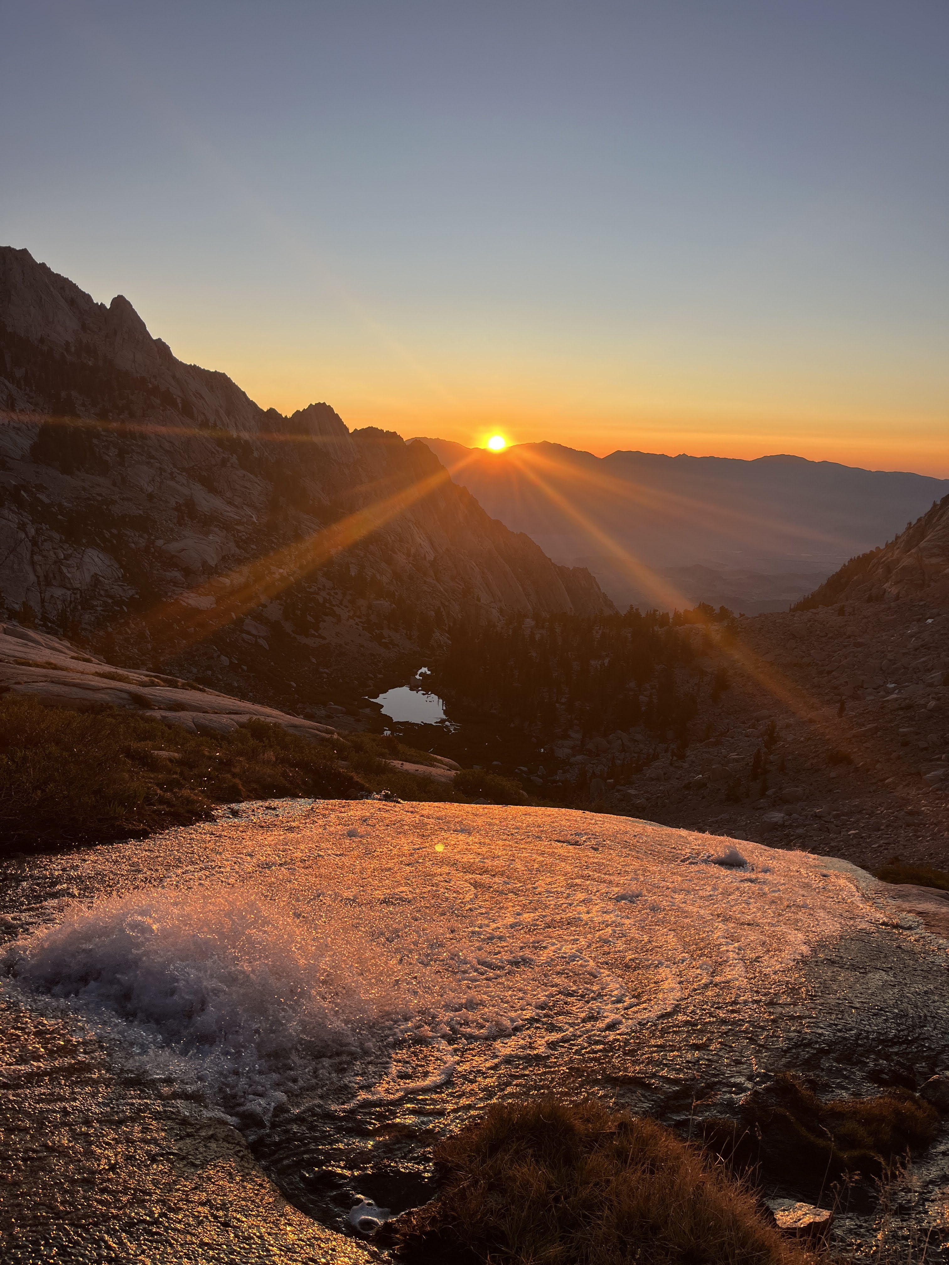
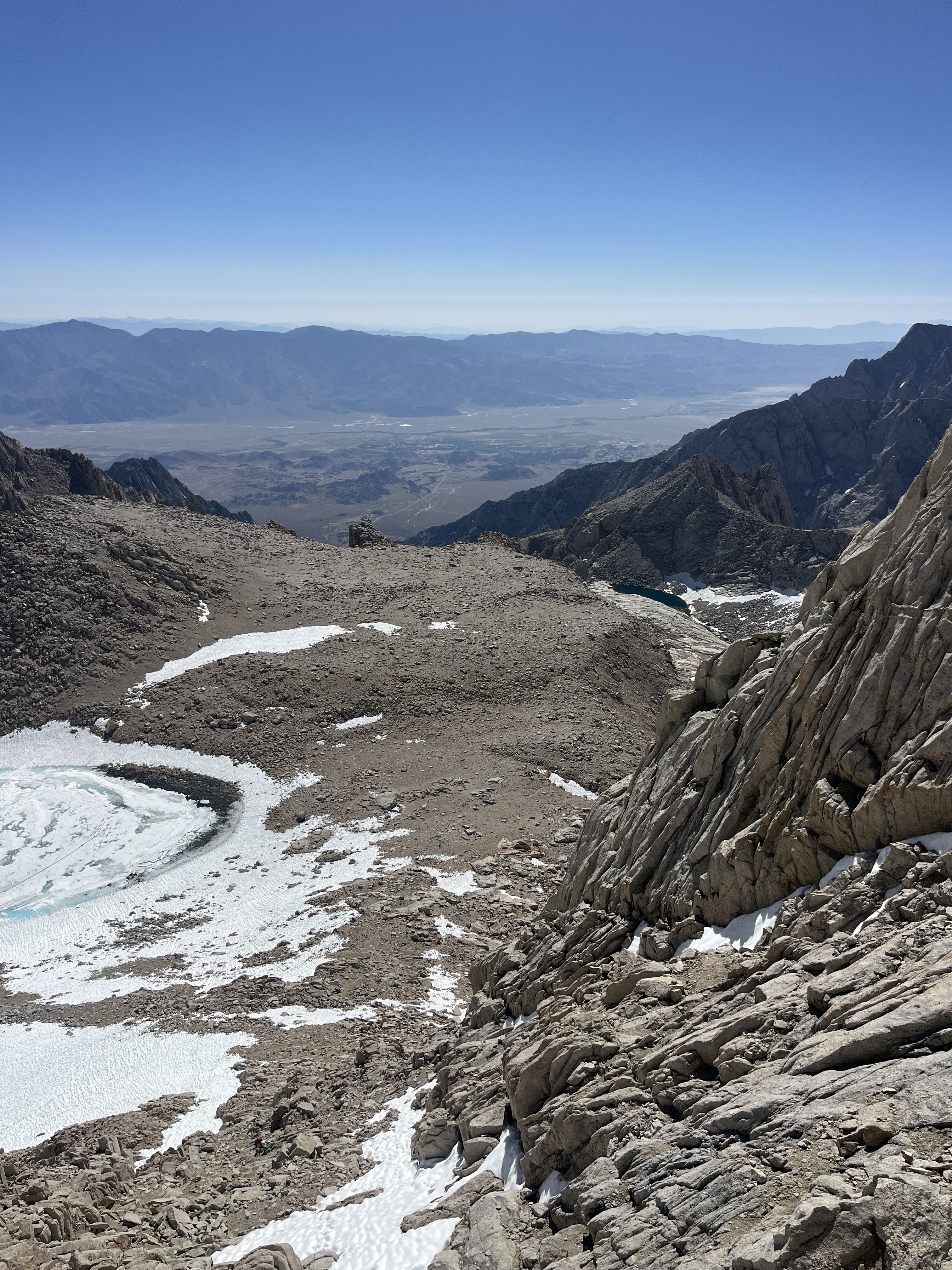
From Lower Boy Scout Lake onwards, the hiking transforms into odious talus fields. After following Lone Pine Creek to the eastern shore of Upper Boy Scout Lake, the route turns sharply up to the right to Iceberg Lake. Iceberg Lake is the ideal spot to refill water although it will probably be partially frozen depending on the time of year. From here, begins a steep hike up to the start of the route.
Climbing
At the base, we roped up. Knowing how slow and scared placing trad gear I would be, our party decided to have me follow the entire time. However, this actually worked quite well, and we managed to stay just behind the party simul-climbing in front of us. Our speed was paid for by running it out. On the second pitch which many people say is ill-protected, we moved to the 5.7 variation for better protection. Note that the piton on the standard second pitch has been hammered and can’t be clipped anymore, so it is totally unprotected most of the way. The climb proceeds through beautiful views. For the High Sierra, the rock quality was immaculate. There is a pitch, which I can’t recall, with spectacular fins on it. The Peewee is a massive block of rock with a sharp jagged triangle on its bottom-side. The route climbs right alongside it making it a great halfway marker. Towards the end, things start to enter talus territory. Here, it becomes a scramble with many options. We went left to avoid potentially harder climbing. At almost 3 P.M. exactly, we stood atop the lower 48.
Hiking Out
There are multiple ways to get out. Some, hoping to shave off miles, opt to scramble down to the Mountaineer’s Route to the north. When there’s not enough snow, this is a festival of loose talus according to most reports. The other option is to take the hiking route. Hiking is faster but longer. Before reaching the hike’s infamous switchbacks, there is a significant shortcut glissading down the “chutes” when snow conditions permit. The “chutes” get their name from the slide-like tunnels in the snow worn in by climbers glissading. My climbing partner glissaded them, and I wish I had.
At 9 P.M., I reached the car exhausted.